DEEP END
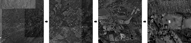
United States Geological Survey aerial photographs used for mapping the earth's surface. This sequence zooms in on the pool that was photographed for the DEEP END project. Note the patchwork quality that results from the amalgamtion of different exposures taken at different times to produce the continuous map.
DEEP END
2010